Your city — Москва?
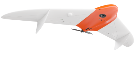
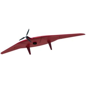
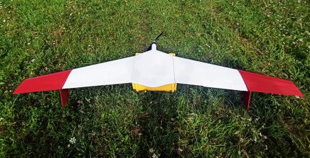
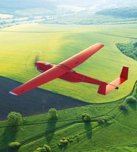
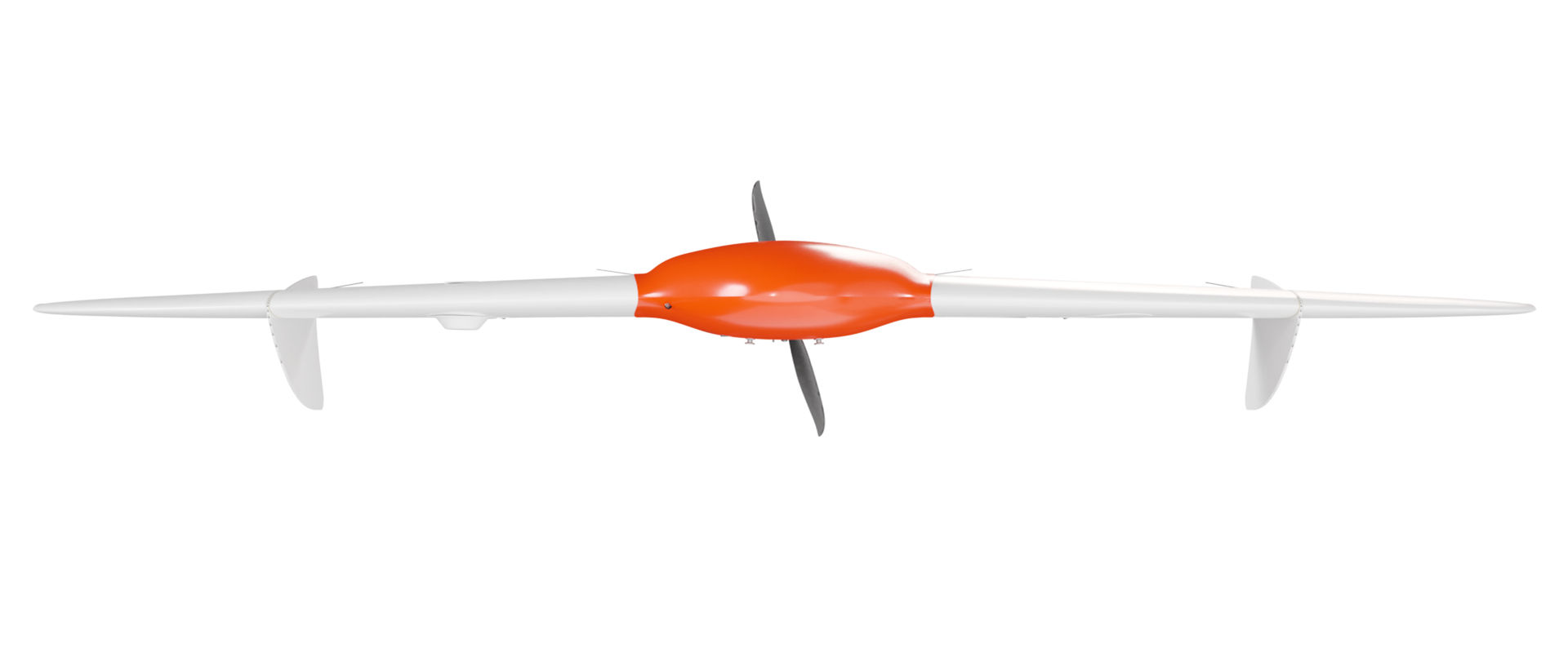
Fixed wing UAV GEOSCAN 201 geodesy
Краснодар
and more
60 городов
Offer valid for the following list of cities:
Краснодар
Сочи
Красноярск
Владивосток
Ставрополь
Хабаровск
Архангельск
Астрахань
Белгород
Брянск
Владимир
Волгоград
Вологда
Воронеж
Иваново
Иркутск
Калининград
Калуга
Петропавловск-Камчатский
Кемерово
Кострома
Курган
Курск
Гатчина
Липецк
Магадан
Мурманск
Нижний Новгород
Великий Новгород
Новосибирск
Омск
Оренбург
Орёл
Пенза
Пермь
Псков
Ростов-на-Дону
Рязань
Самара
Саратов
Южно-Сахалинск
Екатеринбург
Смоленск
Тамбов
Тверь
Томск
Тула
Тюмень
Ульяновск
Челябинск
Ярославль
Москва
Санкт-Петербург
Биробиджан
Нарьян-Мар
Ханты-Мансийск
Анадырь
Салехард
Запорожье
Севастополь
Херсон
Category:
Special machinery manufacturer:
Model:
Condition:
New
Availability:
Not specified
#30009
Specifications
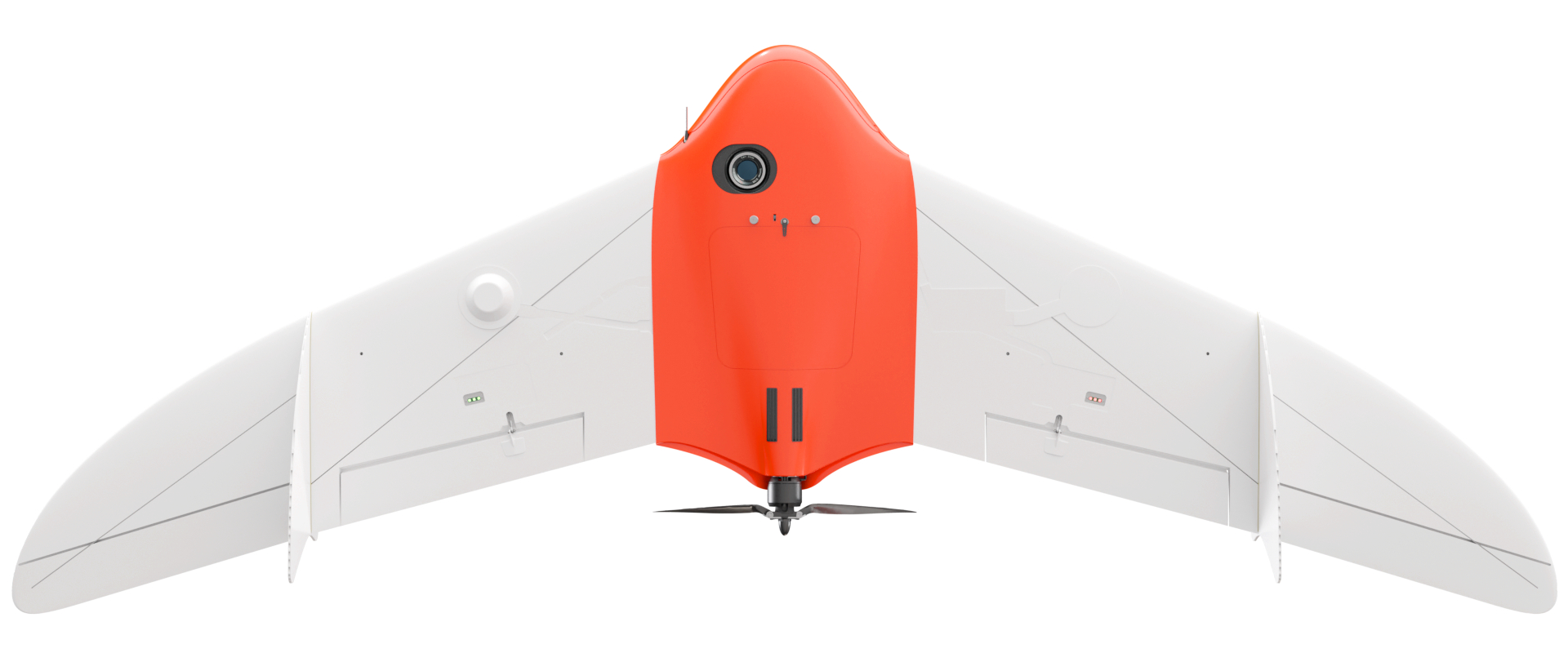
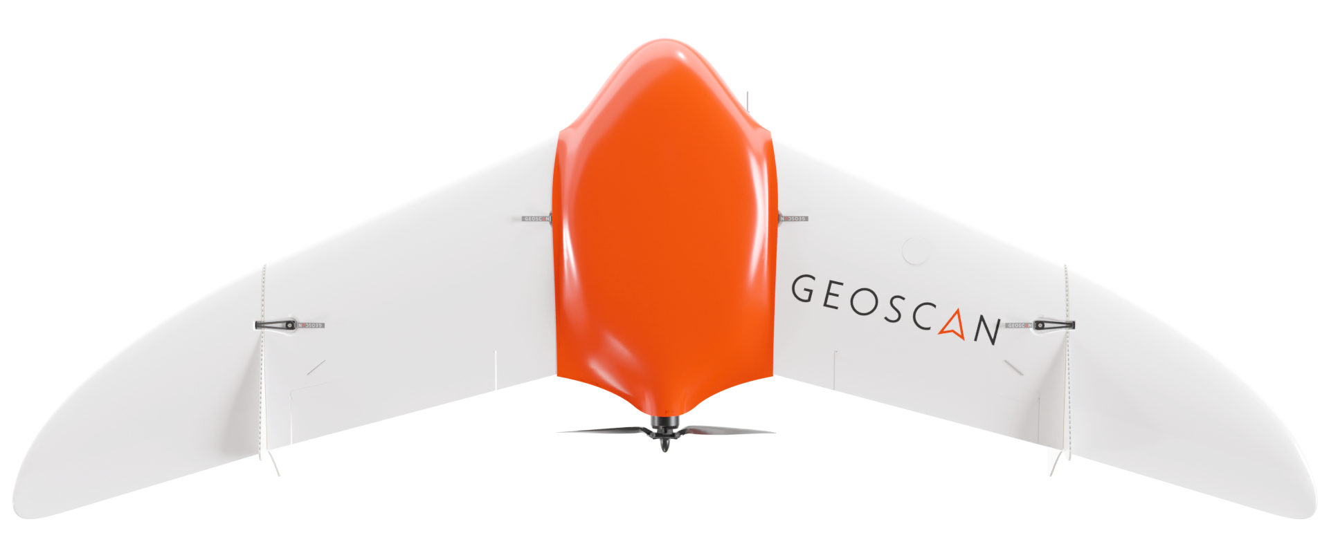
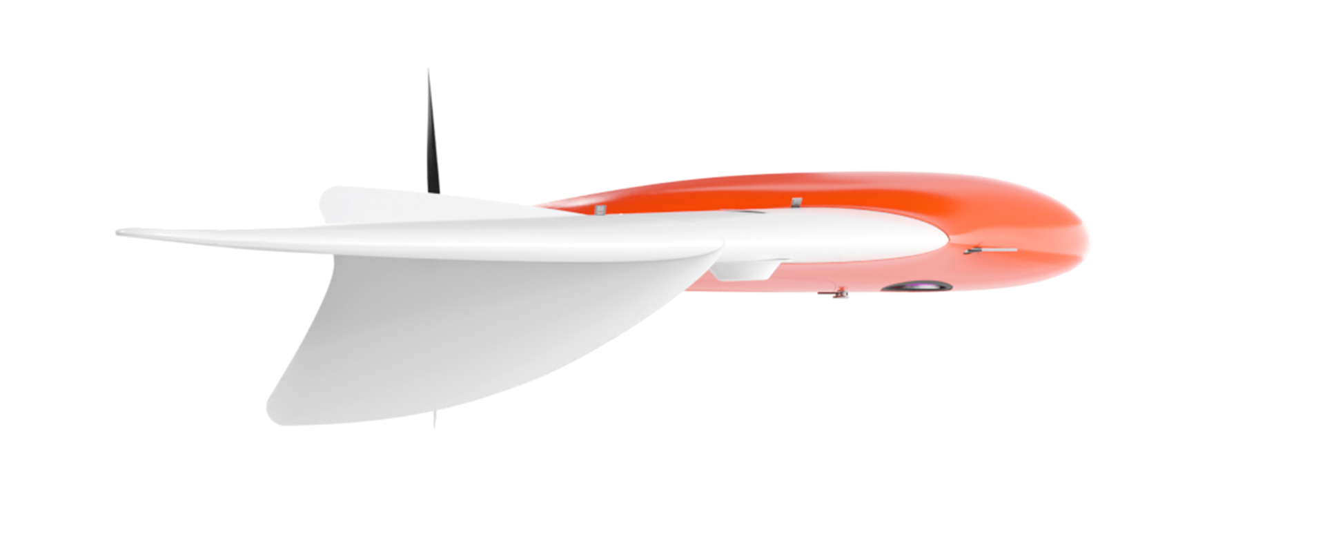
Geoscan 201 Geodesy
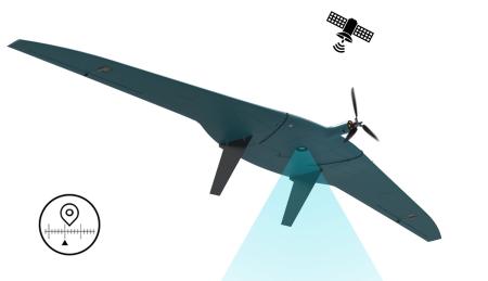
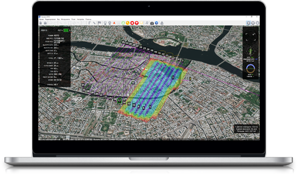
A complex for aerial photography and modeling of vast territories and extended objects with a photogrammetric camera and a GNSS receiver. A complex for aerial photography with a flight time of up to 3 hours. Geoscan 201 Geodesy allows you to shoot up to 80 square kilometers per day and obtain orthophotographs with geo-reference accuracy that meets the requirements of the 1:500 scale. And thanks to the geodetic GNSS receiver on board, it is possible to obtain the exact coordinates of the snap images and improve the quality of data processing.
Flight duration is up to 3 hours
The survey area is 15-42 km2
Max. route length: 210 km
Survey area for 1 flight : at a scale of 3-10 cm/pixels: 15-42 km2
Max. permissible wind speed: 12 m/s
Flight speed: up to 110 km/h
Max. take-off weight: 8.5 kg
Max. Payload weight: 1.5 kg
Overall dimensions: wingspan: 222 cm
Min. safe flight altitude: 100 m
Max. Flight altitude: 4000 m
Operating temperature: -20 to +40 °C
(optionally expandable to -40 °C)
Motor: electric, brushless
Take-off / landing: from a launcher / by parachute, in automatic mode
The Geoscan 201 Geodesy complex includes an unmanned aerial vehicle (UAV) with an onboard GNSS receiver, a launcher in a protective case and a charger in a case.
Fixed-wing UAVs
Wholesale prices
0 ₽

Email
Phone number
Connection will be made via internet - no charges apply. Microphone access required.
Leasing/Insurance
Adding to Favorites
Your comment: